Thursday, April 26, 2018

Day 4: Fort Point to Tiburon Ferry


Day 4:  Fort Point to Tiburon Ferry
(San Francisco to Tiburon)
Circle The Bay Part 3
April 24th 2018

17.1 miles in 2 hrs 46 mins


(Total:  81.0 miles in 16 hrs 12 mins)


I had a real big urge to leave Silicon Valley (and the entire Peninsula) behind and cross over to Marin County today.  Things in my professional life had taken a surprising turn of events (can you say pre-layoff?) and I realized my career as a factotum employee of a Silicon Valley startup is over.  From now on I'm in the executive suite with some say over the future of the organization, even if I'm the only one.

Marin County doesn't feel totally Silicon Valley'ified like San Francisco does nowadays.  They have a dedicated route system of well maintained bike routes.  They are investing in public transit with the new Smart Train, and ferry service is integral to the county, routes from San Francisco to Sausalito, Tiburon, and Larkspur run all day, and some even take Clipper chips (the electronic public transit payment card).

Our long time nanny/housekeeper Tina was from Marin County.  She was a teenager there in the 70's and had first hand exposure to the place and time.  She is now an ex-pat living in Portland Oregon, but stopped by to visit this weekend, and told me a story about a bus trip she took from Marin to Tahoe as a 19 year old girl.

Her bus for some reason broke down, and the bus company made surprise arrangements to get her on a small plane to Tahoe instead, the kind with only a single seat on each side of the aisle.  The plane also waited for another bus of traveling musicians who were famous enough to be able to arrange a flight to Tahoe, instead of sitting in traffic jams on I-80.

The guy with the long hair and beard sat across from her, and they had a good conversation.  She asked him if he and his companions were in a band, and he said yes with a laugh.  When she got off the plane the friends she was visiting told her they were going to a Willie Nelson and Waylon Jennings concert that night.  She got quite a surprise to realize she had already met Willie on the plane.

But the kind of freaky thing about that flight to me is not Willy, but Waylon, who avoided crash-landing in a small plane in an Iowa farm field in the winter of 1959, when I was less than a week old.   He avoided it by giving up his seat to Buddy Holly and opting to ride the cold slow tour bus instead.  Tina not only got to chat with Willie, but she got to fly in a small plane with Waylon, a courageous man who kept on truckin'.*

(*finishing this blog before biking two days later, sitting at the Larkspur Ferry, I could not think of a final phrase to end it, and was about to give up when the place finally suggested something locally appropriate)


View From Point Cavallo
Road to Take Down and Under the Bridge to Fort Baker

View of The Bridge From the North

Approach to Sausalito from the Bridge

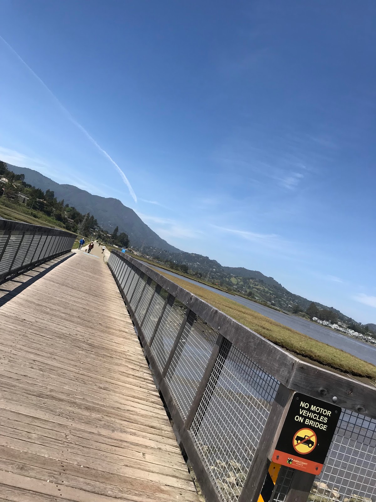
The Mud Flats between Sausalito and Mill Valley
A Motel on 101 near Tiburon
Kombucha of The Day:  Mango Lemon
Rental Bikes On The Tiburon Ferry


Tuesday, April 24, 2018

Day 3: Heron's Head Park to Fort Point


Day 3:  Heron's Head Park to Fort Point
(San Francisco)
Circle The Bay Part 3
April 21st 2018

13.6 miles in 2 hrs 58 mins
(Total:  63.9 miles in 13 hrs 26 mins)


By coincidence my friend from Melbourne Australia was staying in the city today, and we met for some breakfast in a surprisingly good restaurant on Powell St. near Union Square. And because I didn't want to be late, and after I missed Caltrain by a minute, I took an Uber X to Heron's Head Park with my bike loaded into the back seat.

The Third Street corridor south of the AT&T ballpark (and downtown) has undergone extensive development and gentrification in the past decades.  UCSF has built an entire campus of biomedical research buildings.  In the midst of all this is rising the Warrior's new basketball stadium.

After breakfast I carried on around the shoreline all the way to Fort Point, the Civil War era fort built on the point where the southern end of the Golden Gate Bridge now stands. It was beautiful spring day, and I realized there was no chance I was going to get my bike on the ferry back to SF in Sausalito, as that ferry was going to be chock full of rental bikes.

So I didn't make it over the bridge today.  And I had to beat a long retreat to BART at Civic Center.  But the bonus was the best bike lane I've ever used has recently been installed on Polk St., so it was easy to get from the shore to BART this day, and it will be easy when I return.

We lived in San Francisco from 1989 to 1996.  Half of that was in Cow Hollow, the neighborhood above the Marina, and half was near West Portal, on the other side of Twin Peaks.  It was an exciting time, as optimism about the new possibilities of the coming digital transformation was all over.  I remember going to a party to celebrate the creation of the open source Mozilla project out of the Netscape/Mosaic effort.  This combination of music, progressive culture, and high tech was thrilling.  

Now, almost 30 years later, I have some stock in a few startups that no longer need my services,  I have one son who is a musician, another going into progressive agriculture, and a third with all the football-installed business savvy I never had.  And I have become a travel blogger hawking my items for sale on Amazon.  Let's see what we got today.  How about a pair of imported Turkish sandals, useful for slipping off when you walk down to the beach at Chrissie Field?


Kombucha Of The Day


Fermented Trader Joes Hibiscus Juice


Voice Notes

N/A


Saturday, April 21, 2018

Day 2: Coyote Point to Heron's Head Park


Day 2:  Coyote Point to Heron's Head Park
(Burlingame to San Francisco)
Circle The Bay Part 3
April 19th 2018

29.8 miles in 6 hrs 13 mins
(Total:  50.3 miles in 10 hrs 28 mins)


Two days of biking north of San Carlos, and I made it to the city.  This is a lot slower than the first time I biked this direction, when we made it from Palo Alto to Golden Gate Park in a day, loaded down with camping gear taking El Camino all the way.  But if you look at the map above you can see why.  The Bay Trail is more for contemplation than speed.

Planes Landing at SFO with Mt. Diablo in the Background
I took Caltrain to Burlingame and got back to the trail where I left off at Coyote Point.  Biking north from there I found the perfect place to stop and watch runway traffic at SFO, on the shoreline by the Ramada Inn, looking across a low-tide mud flat.  From my vantage point I couldn't see the virtual stop (and go) lights that coordinate this ballet, but they must be there.


Wind Harp, South San Francisco

I crossed the airport's territory using the very convenient and bike-friendly McDonnell Road that winds under and around the terminal.  Convenient tip for myself:  when leaving SFO and southbound 101 is backed up, take McDonnell Road instead, which puts you on uncrowded frontage roads to as far south as Coyote Point.


Leaving the airport behind, I climbed up the hill that Genentech built their campus on, to the very accurately named Wind Harp sculpture.  Coming down off that hill I saw very sleek silver ferries pulling in to the Oyster Point (South San Francisco) Ferry Terminal, which was exciting.  Until I saw they weren't using the terminal, and were instead loading at a private dock.  I asked those waiting whose ferries they were and where were they going, and they couldn't quite say, but admitted they were for the large nearby biotech company.


South San Francisco Ferry Terminal


Ironically, this evening I went to dinner with a friend in the Mission who had just moved back to San Francisco from New York City, where every day his commute was a ferry ride from New Jersey to Lower Manhattan on a private ferry financed by Goldman Sachs that was open for public use.  I guess companies like Genentech and Google aren't in the same sphere of financial solidity as Goldman Sachs (who is?), but perhaps they could consider redirecting some of their wealth spent on private transportation to the growth of public alternatives.  Frankly, if you want your employees to have some sort of appreciation for the world outside your cloistered campuses, sharing their ride to work with the rest of the world is the single biggest thing they could do.


Private Ferry Service for Large Unknown SSF BioTech Company That Starts with a G
I biked by Candlestick Point on my way to Hunters Point.  They still won't let me bike through the former Naval base of Hunters Point, as decades of redevelopment are still getting underway.  So instead I had to bike over the hill to get to India Basin and Heron's Head Park.  On top of that hill there is a new parklet with a viewing platform that is the perfect place to see all the ships from Asia waiting to unload crates of wholesale goods in the Port of Oakland.


For example, I'm sure these knives I have for sale came in that way.  Designed in Switzerland, made in China, liquidated by an auction at Bstock Solutions, and put up on Amazon by me:


By the way, Heron's Head is named in a very literal manner.  I've developed the habit of noting how often place and street names are extremely literal (i.e. the Bayshore Freeway is exactly that, a freeway along the bay's shore).  But the accuracy of Heron's Head (see below) makes me smile.


Heron's Head Park in San Francisco

Kombucha of the Day

Pineapple Grapefruit Kombucha

Voice Notes


N/A

Thursday, April 19, 2018

Day 1: Bair Island to Coyote Point


Day 1:  Bair Island to Coyote Point
(San Carlos to Burlingame)

Circle The Bay Part 3
April 17th 2018

20.5 miles in 4 hrs 15 mins
(Total:  20.5 miles in 4 hrs 15 mins)


I biked down to the Bay and started my third circumnavigation of it on Wednesday.  The first was an series of Uber rides I gave one day that took me first to the airport, then to Sonoma, then Berkeley, then San Jose, then almost home in Redwood City.  The second was a 374 mile counter-clockwise hiking trek last year that took me 30 days to finish.  The third I'm doing on a bike.
Bair Island and a Trek Bike


The moment I got to the start I got that buzz on my phone that let me know my wholesale lot of swimsuits had been delivered back home.  I realized at that moment I had leveled-up.  Now I was traveling blogger with merchandise to hawk!  And the joke was on me, because I had invested in replica Baywatch swimsuits that I sell through Amazon Fulfillment centers.  Bay watch?  Something I've learned to to do.


As I biked north, following the shoreline around Redwood Shores and Foster City, I got to appreciate how convenient this biking thing was.  And since I'm temporarily sidelined from running (roll your ankle and don't let it rest enough and your tendons have a way of fighting back), the bike felt like a wheelchair, although more like an uncomfortable barstool chair.


But for me it is the perfect to review my trek of a year ago.  And after a year of percolation, I find I've grown new and interesting insights into the bayfront and how it could evolve in the future.


Take Down Powerlines that Disturb the Bay

Power Lines From San Jose to San Francisco

The trail that wraps Redwood Shores crosses twice under this pair of high-voltage transmission lines that transect the bay from San Jose to San Francisco.  As I've said before, these towers are the single biggest aesthetic blotch on the San Francisco Bay, and they kept me from visually appreciating the Bay for a long time.  

Removing these towers could be part of an ecologically friendly transformation to the bay shore communities of Redwood Shores and its neighbor Foster City.  Which they have to get to soon, because the planet is warming and the sea-level is going to rise.

I directed a tweet at Elon Musk's The Boring Company, in hopes he might catalyze a change that would put these power lines under the bay shore in a new BART tunnel from Millbrae to San Jose.   He should be receptive to the idea, given he lost a VP of Engineering to these towers.

I have to give another shout-out to the The Boring Company. When I traversed the US from San Francisco Bay to Hinton Bay to Chesapeake Bay last September, I wrote a paen to the Interstate Freeway System and how it is a true democratizing presence in our lives that ties everyone in the USA together.  I noted the egalitarian bar had been raised pretty high by these freeways, and hoped hypertubes would support this American ideal of unrestrained travel available to all.  In their public pronouncements since then they have done it one better, declaring human-powered travelers would be a bigger priority than fossil-fuel powered travelers.  Keep on digging!

Redwood Shores Lagoon is Supposed to Be A Deep Water Port

And in other old news, I discovered (on a faded placard) the long straight lagoon that is at the center of Redwood Shores was dredged by the federal government at the turn of last century to create a deep water port!  Can you imagine tall ships docking a block from Oracle?  They wouldn't have to keep the sailboat that won the America's Cup on San Francisco Bay propped up like a statue in the middle of a reflective pond.

And what defeated the federal government in their attempt to create this port?  The power lines.  Yes, those power lines.  The tall ships couldn't make it under them, so they abandoned the project.  Maybe Larry Ellison, the billionaire behind Oracle and the American entry to the America's Cup, could be allied with Elon Musk in finishing this project.  Or maybe these are things that should get done without the help of billionaires.  Isn't that the way the USA is supposed to work?


The Redwood Shores Deep Water Port


Where the Power Lines Cross the Entrance to the Port of Redwood Shores


New Bridge between Redwood Shores and Foster City

As an Uber driver, especially delivering for Uber Eats during the dinner rush, I've become acutely aware that an extra lane of traffic is needed on or next to northbound 101 as it crosses from Redwood Shores to Foster City.  The two lane exit for Foster City is always backed up that time of day, and it propagates congestion back onto the freeway, where we all sit wasting time and fuel.  

And the urban planners of last century made provisions for this.   Edgewater Boulevard in Foster City ends on a wide preserved swath of green space that points directly to Island Drive in Redwood Shores.  I think the Bay and these two Bay Shore communities would be better served by having a roadway that links the two of them


Proposed Location of New Bridge Between Foster City and Redwood Shores

There must be a few people who live in Redwood Shores and work for Visa in Foster City that would appreciate this.  I'm sure there will be NIMBY's on both sides of the bridge, but roads and bridges are always built for the greater good, and a lot more people will be convenienced by this bridge (either directly or indirectly) than inconvenienced, and more efficient trips is better for the Bay's environment.

View Towards Island Drive in Redwood Shores from the terminus of Edgewood Boulevard in Foster City

Open Space at the end of Edgewood Boulevard in Foster City

The Flight Path of The San Mateo Bridge

My final musing for this day is on the impressive span of the San Mateo Bridge that arches over the bay (tall enough for those ships on their way to the existing deep water Port of Redwood City).


In the 1930's this bridge was opened without this arch, and relied on a lift bridge in the middle to allow ships to navigate further south in the Bay.  But now when you drive across it, you get lifted up in the air like you're piloting a plane over the Bay.  Now if that "plane"  was autonomous and entirely electric I could view this bridge as the amazing ride it is.  Almost as amazing if it was a freeway in the sky.


Coyote Point

I wrapped up the day at Coyote Point, where I sat and mused on the eroded mountain range that makes up the terrain of the San Francisco Bay.  Interesting to note that Coyote Point is geologically connected with the Coyote Hills on the other side of the Bay.  They are both local mountain tops that have kept their heads above water.  And from this vantage point you can see the sweep of the backbone of the Peninsula connecting with San Bruno Mt. and then the hills of San Francisco and Marin, on up to Mt. Tamalpais.  It's all a beautiful wave of slowly moving rock.

View Toward Twin Peaks from Coyote Point

Homemade Kombucha of The Day

Pineapple Watermelon Kombucha

Voice Notes


I’m a slow learner of things, preferring to find a visceral connection to a subject before I can really become drawn into it.

And example of this is how I got into computers by slavishly copying and recopying notes for my processor design computer class.

To be able to see the bay as a process unifies my cloistered fascination with computers with my newly found or newly extended fascination with nature.


The Bay looks so beautiful and green in the spring. 

Tuesday, April 17, 2018

Day 0: Circle The Bay Part 3


Day 0:  Circle The Bay Part 3
April 2018


I'm ready to embark on another circumnavigation of San Francisco Bay, except this time clockwise on a bike.  I'll stick as close to the Bay Trail as possible but my bike isn't a mountain bike ready for anything.  And it wasn't a mountain bike the first time I rode through the Bay Area in 1980 either.  In fact they didn't exist as far as we knew up until that moment peddling through Fairfax in 1980 and getting approached by a bike store owner who wanted to show off his latest invention of an all-terrain highly geared two wheel bike.  It made me feel California was so cool and ahead of the times.

I wrote postcards to my girlfriend back in Minnesota every day of that trip.  One night we stayed with the aunt of the guy I was riding with in Palo Alto.  I had a postcard to mail and asked if I could leave it in her mailbox, but she said I should take it to a street-corner box because her mail-person didn't like to pickup mail while delivering.  So I have a memory of riding up El Camino a town or two before finding a US Post Office that in memory I've convinced myself is the town we've lived in for almost twenty years.  I will have to go run that postcard down.

Now for this trip, instead of a postcard, I'll write a blog entry, which will go on my permanent record (hey I just found my previous attempts at blogging!:  http://scottsviewport.blogspot.com)

A year ago I hiked around the entire San Francisco Bay.  It took me 31 days of walking 4 days a week for a total of 374 miles.  I used as much public transportation as I could to get to the start of each new day of walking, augmenting with either the buying or selling of Uber rides.  It was a great distraction from obsessively following Twitter breaking news on the Watergate of my adult life.  Still as true as it was a year ago, except now more people are aware of what we're dealing with.

I want to get back out there and re-experience every bit of the bay's shoreline.  Things are hopefully changing for me in the near future, and I might have a future doing more than walking (or biking) by Silicon Valley.  But I am very glad I've done these treks when I had the time.  I've come to love San Francisco Bay in a way that alluded me for decades.  Now I can think of it as a massive, powerful, and divine body of water instead of a shallow basin encroached and encaged by bridges and freeways.  It is not something to disrupt.  It is something we must disrupt ourselves to protect.

TAGQ Episode 10: Cartoon Penguin Rock Stars and The Winter That Wasn't

 TAGQ Episode 10:  Cartoon Penguin Rock Stars and The Winter That Wasn't Sparky the Fire Chief Sparky The Penguin from Tom Tomorrow (Dan...