Wednesday, May 30, 2018

Day 15: Richmond Marina Bay to El Cerrito Plaza BART


Day 15:  Richmond Marina Bay to El Cerrito Plaza BART 
(Richmond to El Cerrito)
Circle The Bay Part 3
May 28th 2018

6.0 miles in 1 hrs 30 mins

(Total:  263.9 miles in 48 hrs 31 mins)


Today was Memorial Day, and some of it needed to be spent in a park.  I found a spot on top of a hill near the bay to sit and watch barbecuers and swimmers and runners and bikers.  And I got the photo I wanted, one that evoked an impressionist Seurat painting.

I stopped to grab a tempeh (fried tofu) and swiss sandwich at the dog park near the bay.  The tempeh wasn't as good as last year, it seemed like they had embedded some other large grain in it, like corn.

When I had to the choice to wrap up the day by either biking to downtown Berkeley, a place I've been many times, or just finishing up at the El Cerrito Plaza BART, a place I've never stopped at, I chose the new experience.   The El Cerrito Plaza is a very suburban shopping experience with parking lots and chain stores.  A 1970's production, just like BART.


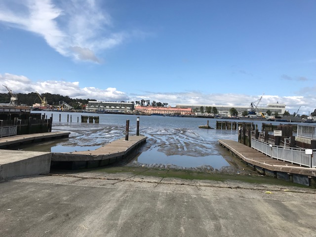
Richmond Marina Bay

Great Pedestrian/Bikeway along the bay in Richmond 
Memorial Day in the park, Seurat style


Sloughs near Richmond 

Bay Trail Bridge

Point Isabel Regional Shoreline and Dog Park


An engineered creek leading up to El Cerrito

By the Bay Bridge on the way home


Monday, May 28, 2018

Day 14: Point Richmond to Richmond Marina Bay


Day 14:  Point Richmond to Richmond Marina Bay (Richmond to Richmond)
Circle The Bay Part 3
May 24th 2018

11.9 miles in 1 hrs 41 mins

(Total:  257.9 miles in 47 hrs 1 mins)


I find myself repeatedly returning to the Richmond BART station, taking my time to explore the fascinating complexity of Richmond. It is as industrial as San Francisco, without the same population.  The bayside hills backed by flat land just across the bay from San Francisco was a perfect setting for a very industrial harbor hooked up to a transcontinental railroad.   Bridges and freeways have migrated this advantage elsewhere,  but biking thru Richmond I can see what a powerhouse of a city it was.


Railway turned into Greenway in Richmond

Quaint Point Richmond

I started the day in the small downtown of Point Richmond, then tried to bike out to the end of Point San Pablo, beyond where I-580 crosses the bay on the Richmond-San Rafael Bridge , but this is a planned part of the trail that is not open at all, because of the Chevron refinery. So I turned around and headed south to the Richmond Ferry Point.


Train tunnels to the Richmond Ferry

View from Richmond Ferry Point

After the Ferry Point, the Bay Trail goes by the Brickyard Cove Marina, the former Richmond Brickworks that built the city, now converted into an Agrestic on the water (a Weeds reference about all the little houses that look all the same).  I find myself attracted to the idea of living in a little suburban development like the one I grew up in, but instead of being on the edge of a wetland a thousand miles upstream from New Orleans, this would be on solid ground hanging on the edge of the bay, separated from the rest of the people in the Bay Area by water and hills and rails and freeways.


Brickyard Cove Marina


Pelican sculpture at Brickyard Cove Marina

I must admit I sometimes lose inspiration in writing about this trek, but I realize that is me, not the section of the trail I'm traversing.  There are stories here to be uncovered as fascinating as the shinier ones with better publicity in other corners of the bay.  And then right here I need another sentence to finish this blog entry, but it isn't coming.  Oh well.  Back to biking.
.
Electric cars for export

A maritime town

Dredging the entrance to Richmond Harbor Channel

Richmond BART Station artwork

My Biking Backpack


Thursday, May 24, 2018

Day 13: Bay to Breakers


Day 13:  Bay to Breakers
(San Francisco to San Francisco)
Circle The Bay Part 3
May 20th 2018

8.3 miles in 2 hrs 44 mins

(Total:  246.0 miles in 45 hrs 20 mins)


Last year when I was walking around the bay, I fit an extra loop into the trail in San Francisco by including the Bay to Breakers running event in my trek (and a hike back to the Golden Gate Bridge with my wife to close the circle).   This year I'm off in Richmond on the trail at the time of the race, and I can't run anyways because I'm still recovering from an injury.

But I paid for the bib, so I was going to walk it.  Which a lot of people do.  It's a nice 7 mile stroll straight across the city, where you don't have to deal with any traffic or sidewalks or even scooters along the way.  The ratio of naked women to naked men in the event remains disappointingly low, and the only team dragon that was notable enough to remember were synchronized swimmers this year, but the event is a lot of fun, with the music pumped from house parties on the side of the route getting better every year.


Bay to Breakers Starting Line, C Corral

Construction crew on new overpass to connect I-80 to the new TransBayTerminal
(only second overpass on entire route)

Tory Sympathizers
Hayes St Hill
Party on the side

Big Spirit


Mobile Two Person Band


Synchronized Swimmers

Groovy Judy in her spot

Taking a break from the Bay to Breakers in the Fuchsia Dell
New sign needed for the Fuchsia Dell
 At the end they were out of coffee and ice cream by the time the walkers made it.  I got a twinge of that feeling of having to deal with super acquisitioners without even the grace to share with their cohorts, but I imagine the volunteers handing the stuff out had gotten to the point of wanting to dump the stuff in bulk.  And us walkers weren't the target demographic I'm sure.

I had parked before the race near the San Francisco Zoo, and taken the Muni L Taraval train down to the start near the bay.  At the end I took the 18 Bus south along 46th Avenue back to the zoo.  I'm pretty sure I was the only person to take these two convenient modes of public transit to/from the race. Or at least the only walker.  No one else get on the bus with a bib.

Reconstructed Windmill in Golden Gate Park

L Taraval

Day 12: San Pablo Creek to Point Richmond


Day 12:  San Pablo Creek to Point Richmond
(San Pablo to Richmond)
Circle The Bay Part 3
May 18th 2018

8.0 miles in 1 hrs 48 mins

(Total:  237.7 miles in 42 hrs 36 mins)


I took Caltrain then BART back to Richmond, and biked back out to the trail where it makes a loop around a landfill hill on the edge of the bay.  This is a part of the trail I skipped when walking, and a part of the trail that made me glad I upgraded to gnarlier bicycle tires.  Nowadays this hill is used for composting yard waste and generating methane gas.  There was a point on the trail where that stomach acid smell of digestion was in the air.

But aesthetically, the hill is not a bad addition to the mountain ridges that poke their backs out of the bay's mud.  It almost naturally pairs with the high ground of Point Richmond when viewed from the Richmond Parkway that swings by the bayshore at this point.


Mural in Richmond BART Station

Landfill Hill with Bay Trail Loop by San Pablo Creek


Pt. San Pablo to the Left, Landfill Hill to the Right


At what point does a zoomed photo become an oil painting?
It was already 2 PM when I made it to the small historic downtown of Point Richmond.  The Bay Trail does extend from here out the end of Pt. San Pablo, but it is not a loop because of the reserved use of the northern side of the point by the other oil refinery that takes up prime scenic real estate on the bay.  I haven't decided yet whether I like the orange tanks of this Chevron refinery over the white tanks of Phillips 66 north in Rodeo.  

Either way I have to admit I am a consumer of their product still.  But I look forward to a time when the only gas made in this part of the Bay Trail is from our composted yard and kitchen waste, and the Bay Trail can circle Richmond Point through a new bay park.

Chevron Richmond Refinery


Richmond Auto Ferry Mural


Friday, May 18, 2018

Day 11: Vallejo Ferry to San Pablo Creek


Day 11:  Vallejo Ferry to San Pablo Creek
(Vallejo to San Pablo)
Circle The Bay Part 3
May 16th 2018

27.9 miles in 4 hrs 27 mins

(Total:  229.7 miles in 40 hrs 48 mins)


On Sunday when we took the Vallejo Ferry back to San Francisco I spotted a large white stadium size building near the shore just north of Pinole Point, the fishing pier that juts a quarter mile out into the bay where the Pinole Wharf used to stand.  I googled the area and found it was an Amazon fulfillment center (insert picture from ferry here).  I've never shipped inventory there, so it was a bit of a surprise.  Maybe they have different tiers of fulfillment centers, the long tail inventory kept cheaper by being more remote to large populations.

After crossing the Carquinez Bridge, the Bay Trail traverses Rodeo, Hercules, and Pinole in the most promising sections of the trail, and the most frustrating at present.  This terrain is controlled by the curve of railroad tracks as they bend from east-west in the Carquinez Strait to the north-south alignment through Richmond and onto the East Bay.  Land long neglected for public use, the regional parks are working on a plan to hook up all the stretches of trail that exist into one smooth path.  A beautiful bridge is under construction to carry pedestrians and bicyclists over the tracks at one crucial junction of railroad lines.  That would have saved a mile or so.

And there other issues where trails end at a property owners fence, a field and a train track away from where it starts again.  But the biggest piece of incompletion is near where all the Amazon warehouse constructions is furiously under way.  I have hopes in a year this section will be twice as complete as it is today.


My Morning Office Space on the Vallejo Ferry

Keeping that mirror on

Special Giants Game Ferry from Vallejo


Boat Launch across from Mare Island Naval Works

Piloted Barge towing Pilot Boat out of the Carquinez Strait

Carquinez Bridge over the Carquinez Strait


Oil Terminal

Superfund Site?  Former Railroad Switching Yard for Toxic Stuff?

Approaching the Phillips 66 Refinery

Always with the Trains

Victorian House with a Bay View in Hercules

Scenery you can catch from Amtrak

Pseudo-downtown Real Estate development near the bay in Hercules

Future Bay Trail Construction Site in Pinole

A mural of Pinole's historic past as an agricultural train stop


Amazon Fulfillment Center built right next to the tracks

Brown Pelican on the Pinole Point Pier living off of fish scraps

Ding, Ding, Ding


TAGQ Episode 10: Cartoon Penguin Rock Stars and The Winter That Wasn't

 TAGQ Episode 10:  Cartoon Penguin Rock Stars and The Winter That Wasn't Sparky the Fire Chief Sparky The Penguin from Tom Tomorrow (Dan...