Sunday, May 13, 2018

Day 9: Petaluma SMART Station to the Bear Flag Republic


Day 9:  Petaluma SMART Station to the Bear Flag Republic
(Novato to Sonoma)
Circle The Bay Part 3
May 12th 2018

15.6 miles in 1 hrs 45 mins

(Total:  162.0 miles in 30 hrs 12 mins)


Laura and I biked to catch Caltrain to San Francisco, then biked to the Larkspur Ferry, then biked to San Rafael to catch the SMART train to Petalum, then biked to Sonoma.  And this was the easy day.

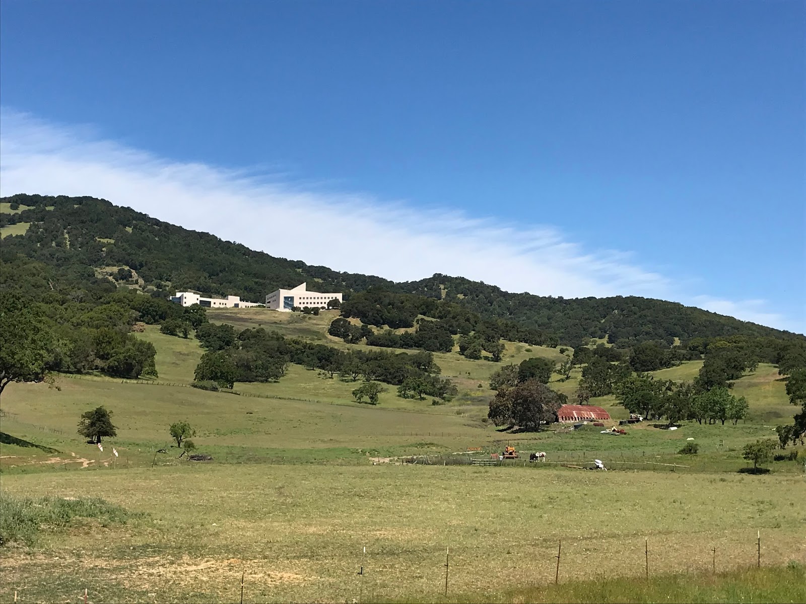
We picked up a spare inner tube in Petaluma, then rode over the 400 foot hill that separates the Petaluma watershed from the Sonoma watershed.  We stayed the night at the historic and rather old Sonoma Hotel, right on the edge of the Sonoma town square, down the street from the barracks where Mexican General Vallejo decided to take down the Mexican flag and raise the Bear Republic flag in 1846.   He was a traitor to Mexico, but a hero to new state of California once the Bear Republic joined the Union.

Next to the General's barracks is the Sonoma Mission.  Given Mexico got its independence from Spain in 1821, by 1846 were there vested Spanish and Catholic interests wanting to pluck a cherry back from the Mexicans?


The start of the adventure

Larkspur Ferry

Farmer's Market pastry consumed on the Larkspur Ferry

Seed Bank, Petaluma

New SMART train lift bridge over the Petaluma River

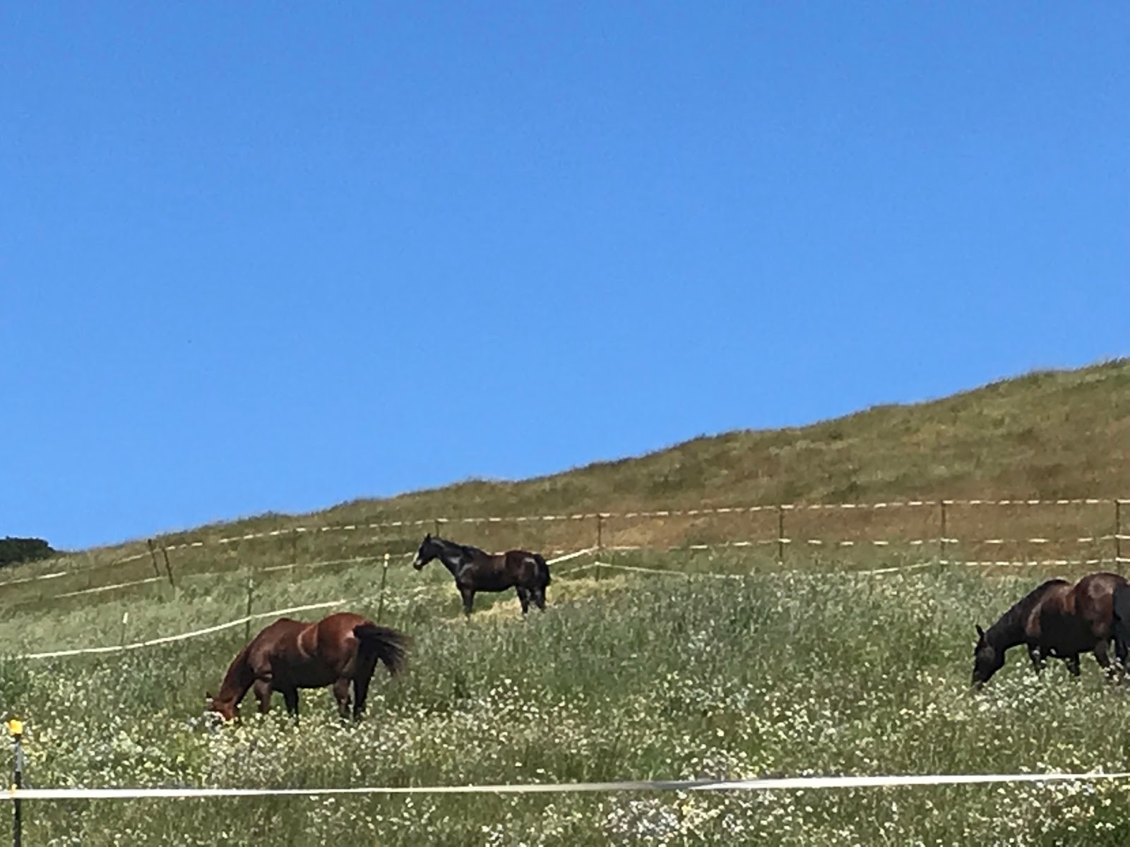
Biking out of the Petaluma Valley
Sonoma City Hall

Where the Bear Flag was raised


Pineapple Grapefruit Kombucha

Saturday, May 12, 2018

Day 8: Hamilton AFB to Petaluma SMART Station


Day 8:  Hamilton AFB to Petaluma SMART Station
(Novato to Petaluma)
Circle The Bay Part 3
May 8th 2018

24.9 miles in 3 hrs 32 mins

(Total:  146.4 miles in 28 hrs 27 mins)


Hamilton AFB Repurposed Hangar

Another day taking a train, then ferry, then train to the trail.  Getting off the SMART (Sonoma Marin Area Rail Transit) train in southern Novato near the repurposed Hamilton Air Force Base, I biked along the restored wetlands and then swung inland to find the next  SMART station just north of downtown Novato (the downtown Novato station opens next year).

Hamilton AFB Wetland Restoration

Bay Trail Signage

Novato City Hall
I biked all the way down the central commercial street of Novato.  This distance from the bay, Novato was probably more of an agricultural town than a maritime one.  And like San Carlos it has centralized its small town feel on this long street.  It's like a San Carlos with no Belmont and no Redwood City on its boundaries (not quite true, as the train ride through made clear later in the week -- there is almost continuous urban development between San Rafael and Novato, at least along the train and 101).

At the far end of town, on the first significant hill, I took a break in Pioneer Park, which is really Pioneer Cemetery with playground and ball field attached.  The pioneers still buried up here weren't taking any chances on the bay waters rising in the future.

Pioneer Park Cemetery in Novato

Novato Marin SMART Station

Once I made it to the next SMART station in northern Novato, I decided to just go for it and shoot for catching the 1'ish southbound SMART train in Petaluma a simple 2 hour bike trip to the north.  But because of construction on 101 (adding a desperately needed extra lane to part of the daily congestion south of Petaluma) this bike route took me far off into the San Antonio valley, an extremely rural region on the border between Marin and Sonoma counties.

Rural Stretch Between Novato and Petaluma

Birkenstock's Abandoned Headquarters

Bike trail through Olompali State Park that interrupts 101 frontage road


Two Cows with Two Noisy Bells

Detour onto Rural Roads


Horse Ranch outside Petaluma

Petaluma River

Unknown Kombucha, Previously featured

After making it to Petaluma and back in one day on a bike, I'm taking the rest of the week off, until Saturday that is, where Laura and I are going to bike from Petaluma to Vallejo with an overnight stay in Sonoma.   Here is the emoji for the first day of that trip:

🚴‍♀️ 🚴‍♂️ 🚆 🚴‍♀️ 🚴‍♂️⛴ 🚴‍♀️ 🚴‍♂️ 🚆🚴‍♀️ 🚴‍♂️


Tuesday, May 8, 2018

Day 7: Marin County Civic Center to Hamilton AFB

Day 7:  Marin County Civic Center to Hamilton AFB
(San Rafael to Novato)
Circle The Bay Part 3
May 3rd 2018

9.7 miles in 1 hrs 26 mins


(Total:  121.5 miles in 24 hrs 55 mins)


Getting off the Larkspur Ferry today, the pavement on the pedestrian/bike bridge over the main road felt really rough.  I finally had to admit my rear tire was flat.  Luckily there was a bike repair shop right at the foot of the bike bridge, opening in less than an hour.

This gave me an opportunity to upgrade from by mostly bald road tires to something with a little more tread.  Just in time for biking an unofficial part of the Bay Trail that connects San Rafael to Novato on a levee between sunken agricultural fields near the bay.  Only on the northern end of this segment do you see the "Do Not Trespass" sign on what is clearly a well used trail.

All the travel to and from Marin County limits how much biking I can get done in a day, but then again all the travel on trains and boats is part of the fun.  And I'm enjoying exploring every stop of the brand new SMART train (Sonoma-Marin Advanced Rail Transit).


Electric Bike and Repair Shop in Larkspur


San Rafael Sewage Treatment Pond

SMART Train Tracks

Unfinished Bay Trail
Sunken Agricultural Fields Near The Bay
SMART Train Hamilton Station


SMART Train Hamilton Station


SMART Train Tracks

On the Larkspur Ferry Back to San Francisco
San Quentin Viewed From the Larkspur Ferry

View from Larkspur Ferry


Fuji Apple Kombucha


Thursday, May 3, 2018

Day 6: Larkspur Ferry to Marin County Civic Center


Day 6:  Larkspur Ferry to Marin County Civic Center
(Larkspur to San Rafael)
Circle The Bay Part 3
May 1st 2018

17.0 miles in 3 hrs 21 mins


(Total:  111.8 miles in 23 hrs 29 mins)


I'm using an incredible number of different means of public transit to get to and from Marin County in the stretch of the trip, and I feel incredibly lucky to have invented this excuse for doing this, a job that requires investing in getting there over rather smooth rail and water.

First I take Caltrain to 4th and Townsend in the city, then I ride up the well marked clean green bike lane along the Embarcadero sea wall.  Little traffic from the remaining piers means very few reasons to halt.  And the local custom is to use Idaho rules on the stoplights, bolstered by the fact there is no cross-traffic at most of the lights.  Just the view of the bay.

Then quick grab a coffee at Peet's at the Ferry Building at the end of Market and board the sleek two-story catamaran ferry that takes only 30 minutes to cross to Larkspur, a distance of 13 miles.  

Today the ride begins at the ferry, but other days I'll be using the ferry to get to Larkspur, then biking to the new Marin County Smart Train station in downtown San Rafael, the current southern terminus of the line.   To get there you bike through the train tunnel that used to bring freight down to the Larkspur and Corte Madera harbors.  Right now that tunnel is a construction site to bring the Smart Train to within a pedestrian bridge of the Larkspur Ferry.  The bike tunnel built within the railroad tunnel is already open.  But I did get lost a few times trying to make it from Larkspur to San Rafael avoiding the construction and trying to follow tracks that have long been in disuse.


The Lift Bridge That Took Tracks to Corte Madera


And from San Rafael I biked out to and through China Camp State Park, a place where 19th century Chinese railroad workers switched to shrimping as a way of making a living.  They had to be this far away from San Francisco because of racist laws.  But the beauty of the place must have been some comfort.  Until faced with the impact of the ongoing seesaw of plant and animal life in the stew of the bay (counting humans as animal).


China Camp State Park


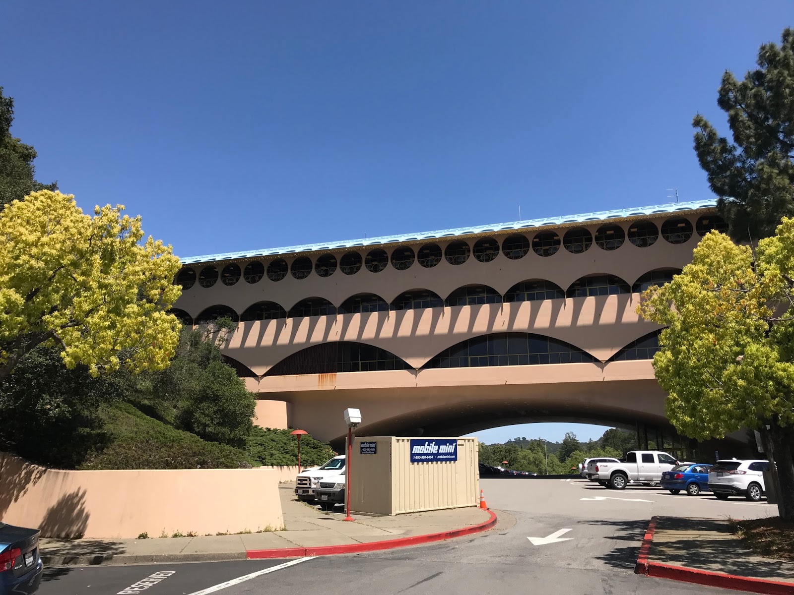
Finally back to the Marin County Civic Center in northern San Rafael, which is a triumph of fitting a building to the terrain, that makes it obvious why Madison Wisconsin had no choice but to build Frank Lloyd Wright's unfinished work for the Monona Terrace.  The building just makes you optimistic about the future, that there will be a place and time where this is common, where government's erect buildings that make people feel good about the future.

Marin County Civic Center
It's shape evokes the terrain, either as an extension of a ridge that is there, or as a literal bridge over an erosion in that ridge.  And its other design features make you feel out of this world, or at least in the Jetsons.


Marin County SMART Train
Mango Lemon Kombucha


Tuesday, May 1, 2018

Day 5: Tiburon Ferry to Larkspur Ferry*


Day 5:  Tiburon Ferry to Larkspur Ferry*
(Tiburon to Larkspur)
Circle The Bay Part 3
April 26th 2018

13.8 miles in 3 hrs 56 mins


(Total:  94.8 miles in 20 hrs 8 mins)

* rode in reverse


I planned on riding from the Tiburon Ferry to beyond the Larkspur Ferry, then doubling back to catch the Larkspur Ferry to SF.  But I got on the wrong ferry and had to do this segment of the Bay Trail in reverse.

Cove leading to Larkspur Ferry and Corte Madera Creek


Well Marked Bike Trails in Marin County
Bike Route Along US 101 Over Corte Madera Creek

The Larkspur Ferry terminal is just south of San Quentin Point (and the infamous prison).  The well-marked bike trails take you easily from town to town in Marin County and I found this bike trail alongside 101 that crosses the Corte Madera Creek.  I did not find this convenient bridge when walking around the bay, but when I went to confirm that from the blog post for that day, I found for unremembered reasons I did not have by app tracking me over the creek.


Paradise Park, Tiburon


The most magical place along this winding bayside road is Paradise Park which faces the Richmond Bridge.  It's a beautiful isolated picnic place on the steep eastern slope of Tiburon.  The topography of Tiburon really highlights the fact that the Bay Area is made up of a mountain range whose peaks are still above sea level.   Biking around Tiburon is like biking around one of those mountain tops.


Car Port with View in Tiburon


Guard Tower for Early Day Tiburon Housing Tract
Tiburon View


Angel Island Ferry


Ending the day at the Tiburon Ferry, I sat and watched the Angel Island Ferry traverse the calm water of Belvedere Cove.  Mt. Angel it should be called.  At 800 feet of elevation, that single peak rises as far above sea level as the entire Mississippi rises from New Orleans to St. Paul. 

I wonder if anyone has ever circumnavigated the Mississippi on a bike?


Watermelon Mango Kombucha

TAGQ Episode 10: Cartoon Penguin Rock Stars and The Winter That Wasn't

 TAGQ Episode 10:  Cartoon Penguin Rock Stars and The Winter That Wasn't Sparky the Fire Chief Sparky The Penguin from Tom Tomorrow (Dan...